Synopsis– Bengaluru’s traffic crisis is altering its real estate market giving connectivity a greater premium than location prestige. The shift in demand toward metro-linked locales, suburban townships, and transit-oriented development (TOD) types of environments indicates the city’s emergence towards 15-minute cities, facilitating transit access to influence investment, planning and sustainable urban development.
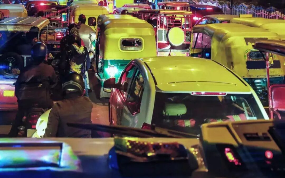
Bengaluru, India’s foremost technology and innovation centre, faces a serious traffic crisis as urbanisation grows. The TomTom Traffic Index 2024 ranked Bengaluru 3rd globally for congestion, with commuters now spending over 134 hours each year in traffic (34 minutes for just 10 kilometres). Traffic is not only a nuisance, but also an agent of change in real estate. Commute time is now commonly used, like price and location, when people buy homes. Commute time factor affects where people live, how developers will build it, and how the municipality plans for the future.
Bengaluru’s Traffic Woes
- Global Congestion Ranking: According to the TomTom Traffic Index 2024, Bengaluru is the 3rd most congested city worldwide, following Barranquilla and Kolkata. Bengaluru is also deemed the 3rd slowest city in the world, as commuters average over 34 minutes to travel just 10km
- Annual Time Lost: People lose 117 – 134 hours a year because of traffic, which greatly affects productivity, mental health, and daily habits.
- Vehicle Overload: As of mid-2024, Bengaluru has 1.16 crore registered vehicles, a whopping 6,000% growth since 1990, and there are 1,200 new vehicles registered every day, which is significantly more than the city’s roadway capacity can accommodate.
- Real Estate Implication: What was once a hassle on the road is now influencing where people live and/or invest, and it is a serious consideration point for real estate.
Changing Buyer Preferences
- Commute Time Over Centrality: Homebuyers today, techies and startup people seem to care less about a prestigious location and would arguably be happy they were 15 minutes closer to work. They are bypassing MG Road and Indiranagar for well-connected suburbs – Whitefield.
- Transit-Oriented Development (TOD): There is now more demand for homes around metro stations, bus corridors, and arterial routes – ORR, Hosur Road, Bannerghatta Road, as buyers and renters are now willing to pay a premium for access to public transit; the jobs weren’t there before.
- Integrated Townships and Walk-to-Work Models: Along with less commuting time, homebuyers and renters prefer integrated townships that incorporate where they work, live, school and shop; the live-work-play environment – almost zero minutes travel time and convenience.
- Satellite Town Demand: Better infrastructure availability + future accessibility with metro stations have created increasing interest in satellite towns such as Hoskote, Varthur, Bidadi – affordability + future connectivity make spaces desirable.
Connectivity-Driven Real Estate Hotspots
- Transport Infrastructure and Metro driving demand: Properties located along existing and planned Namma Metro corridors and arterial roads, or ring roads, have experienced price appreciation of 10–30%. Connectivity has emerged as the key driver of property value.
- Key hot spots:
- Whitefield: Motivated by tech parks and a functioning Purple Line metro, Whitefield remains East Bangalore’s best-performing residential and IT corridor.
- Sarjapur Road: Although it has no metro connectivity at present, the ongoing price appreciation is driven by the proposed Red Line and good access to the ORR.
- Hebbal and Yelahanka: Located in North Bangalore, these areas are well placed relative to Kempegowda International Airport. Hebbal and Yelahanka also have good access to the PRR and STRR.
- Electronic City: Rapidly developing areas, spurred by the Yellow line metro , flyovers and employment zones.
- Kanakapura Road: A lifestyle hub with a new metro and no highway, yet price appreciation is notable.
- Devanahalli: prepared for the future; airport-led growth, STRR backing.
- Developer Positioning: Realty developers such as Brigade, Sobha are seizing the moment, launching projects along the corridors to maximise current and future demand in already connected and labour-saving areas.
Also read: Is Investing in Bannerghatta Road Real Estate in 2025 a Smart Move? Discover the Truth!
Government-Led Infrastructure Projects and Urban Planning Push
- Metro expansion:
- Phase 2 includes the Yellow Line (RV Road–Bommasandra, serving Electronic City), ORR Metro (Phases 2A and 2B), and the Airport Line.
- Phase 3, approved in 2024, further extends metro completion to Old Madras Road, Magadi Road, Kengeri, and the west of the ORR connection for city transit.
- The substantial road projects include:
- Peripheral Ring Road (PRR): 73 km, express corridor relieving the ORR for connection to all major highways in the metropolitan region.
- Satellite Town Ring Road (STRR): 288-km road connecting outer towns (Ramanagara, Doddaballapur or Devanahalli); operational stretches – Dobbaspet–Hoskote.
- Suburban Rail Network: Four-corridor, 149-km system developed for daily commuter rail service with high capacity (operational targets from certain portions for 2026 onwards through to 2028).
- Urban Planning (RMP 2041): The Revised Master Plan (RMP) using Transit-Oriented Development (TOD) principles provides for more walkable neighbourhoods and mixed-use hubs, along with sustainable development uses, which will add to big visible real estate activity that will serve future targeted zones for public transport use.
Suburban Shift and Peripheral Growth
- From Fringe to Frontier: As the city of Bengaluru becomes saturated and too expensive to develop within its core, peripheral areas – Bidadi, Hoskote, Nelamangala, and Gunjur–Varthur – have become the next real estate growth areas.
- Affordable Development Opportunities: These areas provide larger land parcels at an affordable price per square foot, and are well-suited to plotted layouts, affordable housing and self-sustaining townships, including workspaces, schools, and retail.
- Connectivity Catalysts: The emerging metro lines and networks of improved highways and roads have reshaped these previously marginal areas into realistic and viable connected alternatives. The periphery regions are no longer a back-up option as developers are investing heavily; it is the new opportunity centre on the frontier.
Traffic Rankings and Perception Impact
- Global Congestion Perception: Bengaluru has been a top-ranking city for congestion on the global city index, along with a 5–6% annual growth in traffic, which began to impact investors and home buyers perceived confidence.
- Connectivity as a Risk Filter: Buyers and developers are now considering multi-modal connectivity, such as metro, suburban rail and arterial roads as low-risk indications of growth.
- Data-Driven Forecasting: The use of urban mobility data and livability metrics is now part of real estate pricing strategy, forecasting and even master planning. Traffic has now gone from a commuting irritant to an evaluative factor in long-term investment assessments.
Conclusion and Future Outlook: Real Estate in the Fast Lane
Bengaluru’s traffic challenges, once viewed exclusively as a disruption, are now creating opportunities in urban real estate. Connectivity has become the new currency of privilege that replaces pincode. The city’s expanding metro, suburban rail, and transit-oriented development (TOD) models put it on the path of evolution to become a ’15-minute city’ where your workplace, home, and leisure can all co-exist in walkable locations. If Government infrastructure interventions deliver, there will be a base for future growth to happen in commute-driven locations. Bengaluru’s greatest urban weakness could become a roadmap for sustainable, equitable, transit-first development.
Written by N G Sai Rohith
